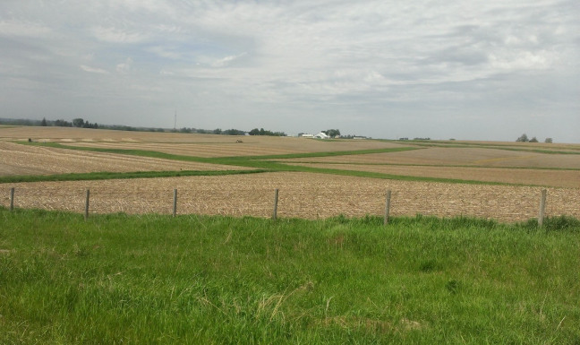
Grass waterways, such as this one, help to avoid channel erosion in areas receiving hill slope runoff. The Agricultural Conservation Planning Framework can help identify locations where grass waterways, and other conservation practices, could be of best use. Photo by Richard Cruse. .
AMES, Iowa – A team led by Iowa State University researchers will expand and revamp an electronic toolbox designed to help farmers and landowners identify the conservation practices best suited for their land.
The team received a $1.5 million grant from the U.S. Department of Agriculture’s Natural Resources Conservation Service to add to and expand the Agricultural Conservation Planning Framework (ACPF), which was first completed in 2013. ACPF relies on data concerning field boundaries, land use and soil conditions for watersheds across the upper Midwest to help guide decisions on conservation practices to improve watershed health and water quality.
The USDA scientists who developed the ACPF have retired, leaving the tool without a true home, said Rick Cruse, director of the at Iowa State. Cruse said the Iowa Water Center currently administers the Daily Erosion Project, which estimates soil erosion and water runoff occurring on hill slopes in Iowa and surrounding states. The initiative shares some important similarities with the Agricultural Conservation Planning Framework, making the Iowa Water Center a good candidate to spearhead the toolbox’s next steps.
“This is a great tool for NRCS and their farm clientele,” Cruse said. “They can make maps of farms and watersheds and identify some options for you on how you can improve water quality. It’s a great conversation starter.”
Cruse and his colleagues intend to expand the region covered by the planning framework so that it can be of use to a wider range of stakeholders. They also plan to develop annual updates to account for changes in crop rotations and changes in soils.
Using the ACPF toolbox requires some knowledge of specialized agronomic software plus soils, land use and elevation data for a specific location. The toolbox predicts how various conservation practices will perform on specific sites. The result is conservation guidance tailored to the features and characteristics of a given location.
The toolbox considers practices such as saturated buffers, wetlands and bioreactors. These conservation practices help to reduce the runoff of nutrients such as nitrogen and phosphorous from farm fields. Nutrient runoff can contaminate drinking water, affect wildlife habitat and contribute to the Gulf of Mexico’s hypoxic zone, an area along the Louisiana and Texas coast in which the dissolved oxygen content of the water is too low to support many kinds of aquatic life.


