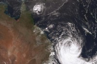
While Tropical Cyclone Oma is no longer expected to cross the coast, it will continue to impact the southern Queensland coast for several days with high tides, dangerous surf and damaging winds.
The current track map shows the system moving slowly south until Saturday, before turning back in a northerly direction, remaining off-shore.
Tropical Cyclone and Flood Watches have been cancelled, however cyclone track maps will continue to be issued every six hours until the system is no longer a threat.
Queensland State Manager Bruce Gunn said Cyclone Oma is a very large cyclone, approximately twice the diametre of Cyclone Debbie, and while currently rated a Category 1 system, it is forecast to reintensify to Category 2 strength and maintain this strength for some time.
“We will certainly continue to keep a close eye on this cyclone, until it no longer poses a threat.
“The main impacts are damaging winds along the coastal fringe and big seas, well into next week. We’re observing waves of 3-4 metres waves along the Sunshine, Gold and Tweed coasts with offshore waves in excess of 10 metres.
“These are expected to increase during the weekend. As such a Severe Weather Warning remains in place for dangerous surf, abnormally high tides and damaging winds. This covers the exposed coastal areas from Fraser Island to northern New South Wales.
“Surf and swell conditions will continue to be extremely hazardous for coastal activities such as rock fishing, boating, swimming and surfing. Beaches are closed and authorities are warning the public to stay out of the water this weekend for their own safety,” Mr Gunn said.
Track maps will continue be updated every six hours:
While it is unusual for a cyclone to track this far south, it is not unprecedented. The Bureau has published on blog on cyclones in the southern .


