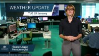
SENIOR METEOROLOGIST, GRACE LEGGE: Hello from the Bureau of Meteorology, with an overview of the severe weather we may see develop over much of the country this week.
Starting in WA we’ve got a low pressure system building near the South West and bringing enhanced rainfall and wind as it deepens.
Depending on the position of the low we are likely to see hazardous surf conditions, possibly damaging winds and even heavy rainfall in some coastal areas.
While these systems are not uncommon for WA it is an unseasonable time of year for them and we do see temperatures drop well below average behind the low.
Once this low moves east we see strong northerly winds drag warm air from northern WA further to the east of Australia and we will see temperatures increase through the south and into the southeast later this week with those stronger winds.
Of course when we see elevated temperatures and windy conditions we could see those fire dangers also increase, on Thursday in South Australia and Friday into Victoria and Tasmania.
Keep an eye on our website for forecasts or warnings if you live in a fire prone areas.
While things are heating up in the south, rainfall is building through the north. The monsoon trough has finally developed just off the north coast bringing some welcome rainfall through parts of the tropics.
Of course when we see a monsoon over water there is an increased chance of tropical cyclone developing somewhere along the trough, so keep an eye on our tropical cyclone outlooks over the coming week.
So while we see the weather once again picking up, keep up to date with all the latest warnings on our website and app, and follow us on Twitter.


