SENIOR METEOROLOGIST, DR ADAM MORGAN: Hello again, with an update on tropical cyclone Penny in the Coral Sea; and like many cyclones we see across the North, Penny’s proving quite temperamental and the forecast has changed quite a bit since yesterday.
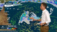
Penny’s currently a Category 2 tropical cyclone in the Coral Sea. The track wobbled around a little bit last night as she reached category 2 intensity and this morning she’s currently 1020 km offshore to the northeast of Townsville, with wind gusts to around 130 km/h near the centre. Now the track we’re expecting for Penny hasn’t changed in terms of direction—we’re still expecting Penny to move to the east through Friday and then remain at Category 2 intensity initially and then into early Saturday as well as she then moves back towards the west, towards the coast, weakening towards Category 1 intensity and then potentially towards a tropical low by Monday—but what’s changed significantly since yesterday is the expected speed of movement: You see now much, much slower and based on the current forecast we wouldn’t be expecting any coastal impacts until Tuesday at this stage.
Now this large grey shaded area around the forecast track shows the range of scenarios still on the cards for the potential movement of Penny over the next few days. And if we take a look at three computer models you can see the spread of movements still possible in terms of Penny and that explains why that grey shaded area is still so broad.
There’s even a chance it may not cross the coast at all and remain offshore completely as it weakens. So over the weekend, make sure to stay tuned to the Bureau website for all the latest forecasts and warnings for tropical cyclone Penny.


